Late July – September
Romp through an alpine wonderland while exploring gold-rich granitic mountains and the diverse human histories of those that live among them.
Though the Blue Mountain range began existence as an island arc, most of what we see today are known as batholiths, or groups of granitic intrusions that were created by magma forced up from below ground when the former islands met with the continent. These batholiths, primarily the Wallowa batholith and the Bald Mountain batholith, make up most of the Wallowas and the nearby Elkhorn Mountains. You can explore their heights in midsummer, after the snowmelt, while learning more about the history and culture of this beautiful area.
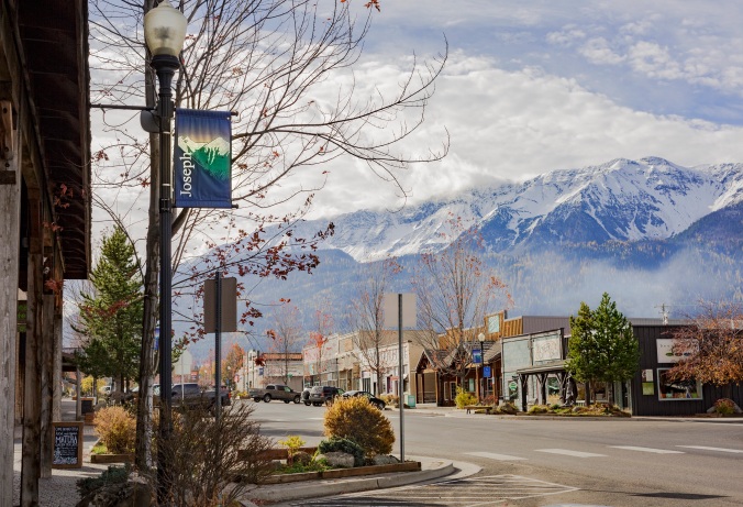
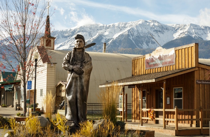
Travel to the charming town of Joseph or stay at nearby Wallowa Lake Village for the start of this trip, to hike* near the Wallowas’ highest point, Sacajawea Peak. Sacagawea may well have gazed upon these mountains: Clark mentioned some that were probably the Wallowas during his return journey with the Corps of Discovery, as he looked out from a viewpoint in the rather distant Bitterroot Mountains of Idaho. The Corps had been the guests of the Nimíipuu for a month’s time in the spring of 1806 at Kamiah (located now within the Nez Perce Reservation), while they waited for the snow to clear in the Lolo mountain pass. Sacagawea wisely spent the time preparing cow parsnip roots for storage to sustain the party in the barren mountains. She may have been uncomfortable about this forced camp among the Nimíipuu, who were traditional enemies of her own Lemhi Shoshone people. Her baby also became very ill during this stay, adding to her troubles. You can learn more about her life and journey by reading Sacagawea Speaks, by Joyce Badgley Hunsaker, and choose from many titles about her for little ones that may accompany you upon this journey.
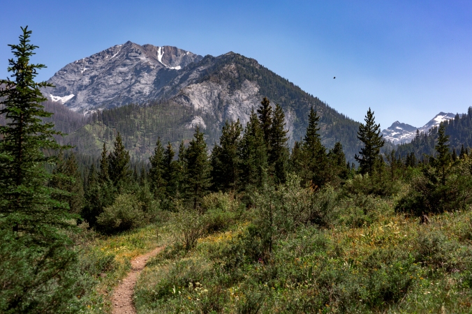
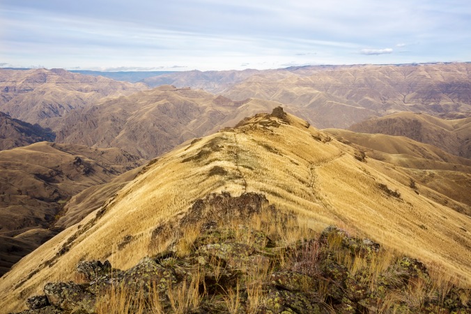
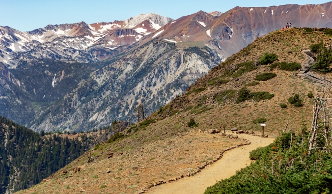
(Sacajawea Peak, the highest peak of the Wallowas, towers over Hurricane Creek Trail.)
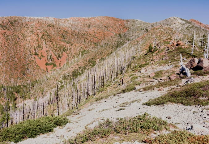
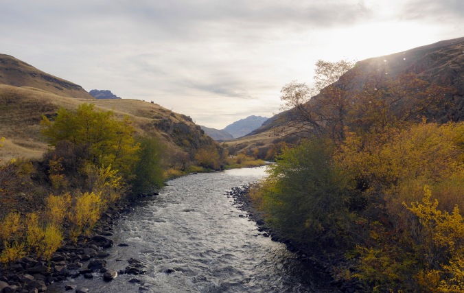
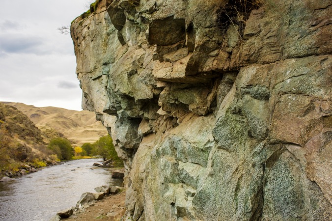
The hike near Sacajawea Peak along Hurricane Creek Trail will take you through scenery created by avalanches of snow, rather than tropical weather. Hurricane Creek was given its name because many of the trees beside it were broken, as if by strong winds — but the main cause of their demise were the heavy snows that slid down the steep slopes of the ancient uplifted seafloor that towers above the creek. Ellen Morris Bishop gives directions to the trailhead from Joseph in Hiking Oregon’s Geology, and both she and William Sullivan in his 100 Hikes/Travel Guide Eastern Oregon, describe the journey to Slick Rock Creek and beyond. Both recommend making a quick side jaunt to the right at the beginning of the trail to see Falls Creek Falls, a sixty-foot waterfall that cascades down from the highest lake in Oregon, Lake Legore, which lies out of sight at the top of the ridge.
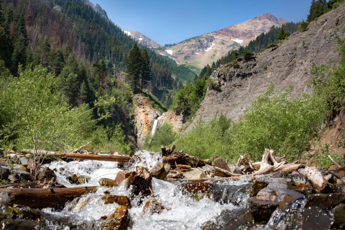
(Falls Creek Falls descends from Oregon’s highest lake, Lake Legore, high above at the top of the Hurricane Creek Divide.)
You might want waterproof boots for this hike, as you’ll be fording across the creeks that run down the ridge to join the Hurricane, though they will probably be passable on rocks and logs without wetting your feet. Late July is the earliest time that fording becomes reasonably safe, after the heavy water from the snowmelt dissipates.
As you continue along Hurricane Creek, you’ll begin to see the impressive Sacajawea Peak before you, which obscures the somewhat lower Matterhorn that stands behind it. After a mile and a half, you’ll emerge from the woodland into the “goat meadows” at the crossing of Deadman Creek. You may even spot moving white specks on the mountaintops — Oregon Rocky Mountain goats, Oreamnos americanus. Once extirpated in Oregon, their population had grown to 200 by 2001 in the Wallowas, after a slow start from reintroduction efforts beginning in 1950.[1]
You may prefer to picnic by the Hurricane near here before turning back around for an easy day hike, but many people like to continue on for another mile and a half to the crossing of Slick Rock Creek for a day’s round trip, while very fit backpacking campers may want to continue on to Echo Lake or the Lakes Basin, as suggested by Sullivan and Morris Bishop, respectively.
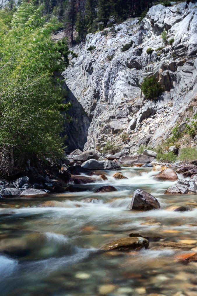
(Hurricane Creek forms a gorge near its confluence with Slick Rock Creek.)
For those who want to experience a high alpine atmosphere without backpacking and camping, the next day you can take the Wallowa Lake Tramway up to Mt. Howard and do a short loop hike, as outlined by Sullivan.
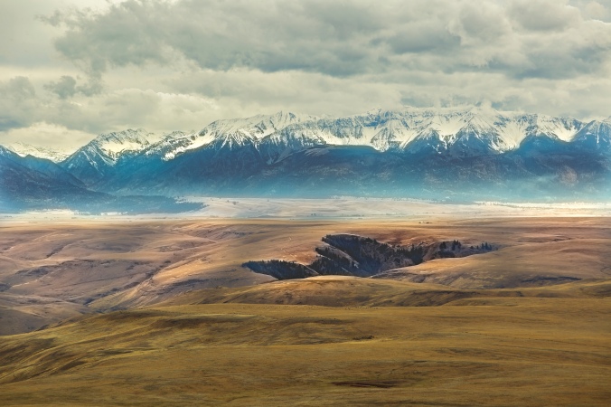
Sometimes called the “Alps of Oregon”, the Wallowas bear more than a passing resemblance to their cousins in Europe. Though The Matterhorn, the second highest peak, on the north side of the Wallowas, is a newer formation, Summit Point, on its southern side, is a former coral reef turned to limestone of the same age as others in the Austrian and German Alps. The corals that became both a part of the European Alps and the “Alps of Oregon” once lived in the same ancient Tethys sea.
(The Matterhorn’s pale granitic peak peeps above layers of younger red basalt and older gray limestone.)
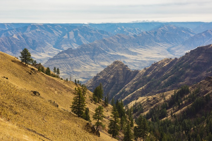
Taking the tram to Mt. Howard will give you a great view of The Matterhorn, with its distinctive white cap made of the exposed granitic marble that forms the core of the Wallowa batholith, beneath the dark gray sedimentary rock of the former ocean floor and the later red basalt flows that came from the Yellowstone hotspot, when it lay beneath Eastern Oregon. Hiking east to the summit of Mt. Howard will bring you close up to the Seven Devils mountains in Idaho, which were also forced up by the collision of the islands and the continent, as well as Hells Canyon and Zumwalt Prairie, sprawling at their feet.
If you can time your trip right, don’t miss a chance to meet the Nimíipuu (Nez Perce) people of the area before leaving the north side of the Wallowa range. The Tamkaliks Celebration has become an annual tradition to practice indigenous culture and to build friendships between the first people and their neighbors. Attend as a visitor with respect for this local event and an interest in getting to know the people of Wallowa, the Nez Perce and other indigenous tribes who gather here. Tamkaliks (“from where you can see the mountains”) is organized by the Wallowa Band Nez Perce Trail Interpretive Center, which you can also visit in Wallowa at any time of year. A new longhouse has been erected beside the river at the powwow grounds, and you can donate to help complete the natural restoration of the site, to restore Coho salmon habitat and native plants, as well as to build a more permanent home for Wallowa Nez Perce culture. See the center’s website for more information.
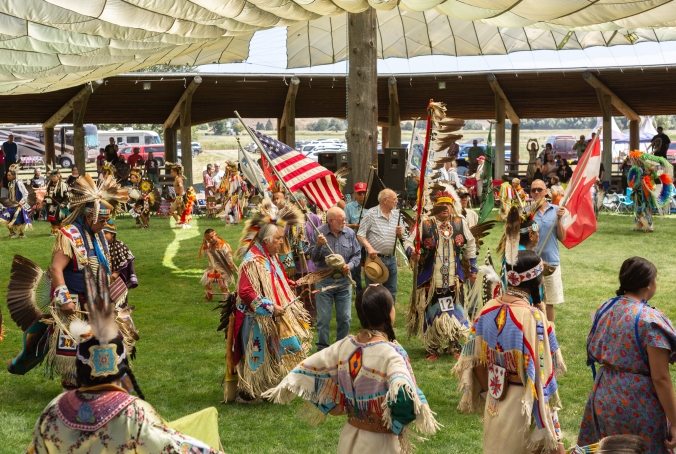
(The Color Guard heads the procession at the beginning of the dance competitions during Tamkaliks. )
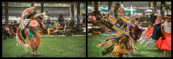
(Dancers of all ages and various tribes show off their skills, styles, and regalia as they dance.)
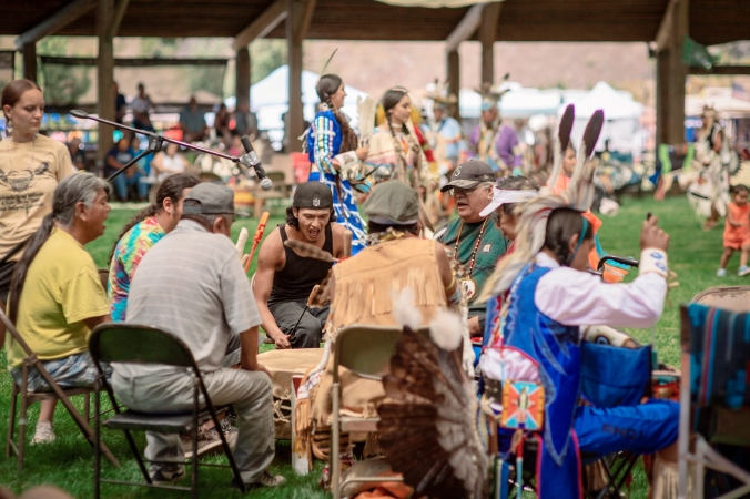
(Drum circles provide the music for dancers and try to trip them up with tricky rhythms.)
Other indigenous people closely related to the Nimíipuu, the Imatalamthláma (Umatilla), Pelúutspuu (Palouse), Walúulapam (Walla Walla), Wánapam (River People), and the Weyíiletpuu (Cayuse) have lived in the foothills of the Blue Mountains and on the low lands around them for at least 10,000 years or so. Together with the Nimíipuu, they are known as the ‘Ichishkíin speaking people, bound together by language, marriage, and territory. You can learn more about them by reading As Days Go By: Our History, Our Land, and Our People; The Cayuse, Umatilla and Walla Walla, published by the Tamástslikt Cultural Institute. Then you can visit the institute in Pendleton before making your way down through the Grande Ronde Valley to Baker City. In addition to a museum and a café opened year round (except Sundays), the Living Culture Village is also open during the summer months at Tamástslikt, located on the grounds of the Wildhorse Resort & Casino, owned by the Confederated Tribes of the Umatilla Indian Reservation.
For your night’s rest, Baker City offers many options for lodging: from the historic Geiser Grand Hotel, the Blue Door Inn, and the Wisdom House and Palmer House vacation rentals to low to mid-range priced motels. For the next day or two, you may want to move up to the Cornucopia Lodge in the mountains to explore the oldest part of the Wallowas.
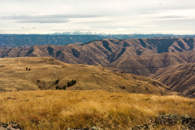
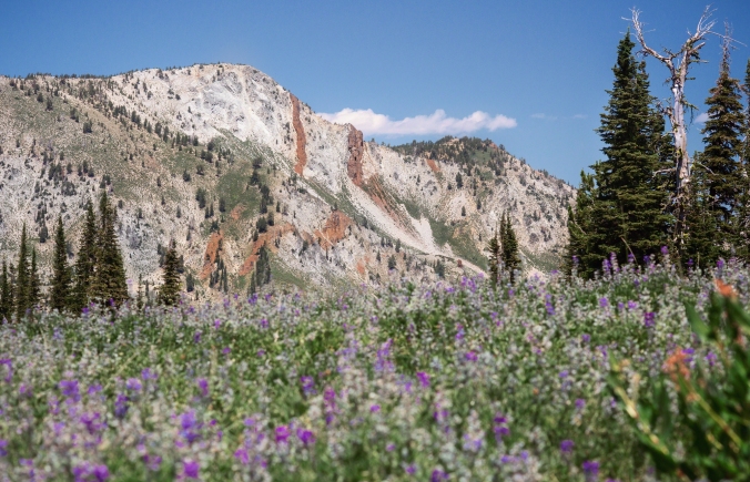
A few hours’ drive from either location will bring you to the trailhead for Summit Point Lookout, a short hike that will take you past the old coral reef where you may be able to spot some fossils of corals, crinoids, or brachiopods. The plant life in the area is a strange mixture of desert sagebrush and subalpine firs and wildflowers, and the elevation provides a commanding view of the desert badlands below you to the south and east, and the Elkhorn Range of the other Blue Mountain batholith to the west.
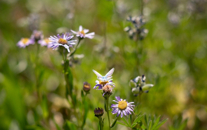
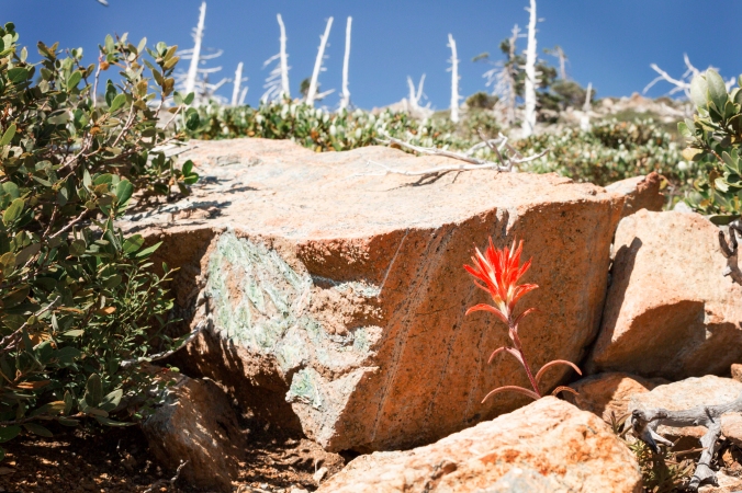
(A blue butterfly rests on purple asters along Summit Point Trail.)
A longer hike straight up from the trailhead will take you to the base of the Cornucopia Stock, a magnificent formation of rare white rock called cordierite trondjehmite. This mountain ridge was created by a fault that transformed the rocks of the old island arc into the pale stone embedded with gold, which was mostly mined out by 1938. The beauty of the landscape still remains, however. In late July, the meadows will be full of blooming lupine and other flowers, where you may even see Rocky Mountain Goat kids playing (so keep dogs leashed.) Ambitious backpackers can follow Morris Bishop’s directions across the ridge to Crater Lake or Sullivan’s guide to Pine Lakes Pass or the lakes themselves. I recommend, however, stopping at the fence that crosses the trail at a high point, and taking a rest in the shade of a stand of trees above the meadows of flowers with their flitting butterflies, below the great white Cornucopia ridge, and enjoying the environment that might be out of a Western version of Heidi, before returning back towards dinner and bed.
(The Cornucopia Stock is made of a rare white rock called cordierite trondhjemite, granitic rock transformed by the pressure of the Eagle fault. Red basalt later poured through cracks in the rock, forming dikes.)
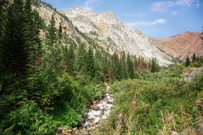
You can also hike from just north of the Cornucopia Lodge the next day, whether you are staying there or not. Along the trail, you can see the handiwork of both nature and humans: from reddish brown slashes of basalt cutting through the pale granitic rocks that mark the fissures caused by the Yellowstone hotspot; to the rocky valley through which Pine Creek runs that has been mined for over a hundred years, changing the face of the landscape; as well as a mine shaft dug into the side of the Cornucopia stock.
(White Cornucopia Peak stands beside Red Mountain, which is made of sandstone and shale baked red by the heat of the granitic intrusion that formed the Cornucopia and the gold therein.)
You’ll also get views of Red Mountain, beside the white Cornucopia, composed of sandstone and shale from the old ocean bed, turned red by the heat when the newer granitic rock intruded. It is contact zones like these that produce precious metals — hence the gold rich stones and the long history of mining. Hiking to Chute Falls and back makes a good day hike, while packers on foot or on the hoof can follow Morris Bishop and Sullivan’s guides to Pine Lakes, and even do a loop that will lead back to the lodge, which also offers day rides, pack rides, and packing and supplying for backpackers in the summer, and accommodates those who bring their own horses.
The lodge and its pack station lie above the ghost town of Cornucopia, which lived and died with the mining of gold. Though it experienced various economic rises and falls from the beginning of its establishment, the end came when gold mining was shut down in America to focus on the mining of metals needed for World War II. The buildings of the hastily built town didn’t change much over the years, and many of them still stand, some renovated and still occasionally inhabited as cabins.
When you drive back to Baker City, which once had a Chinatown, you can also visit the Chinese Cemetery, where former Chinese American residents are memorialized. The work of Chinese American laborers can also still be seen in the area in long rock walls and ditches made during placer mining.[2] Learn more about the miners of Chinese heritage in Eastern Oregon by reading In Pursuit of Gold: Chinese American Miners and Merchants in the American West, by Sue Fawn Chung.
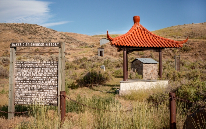
(The Chinese Cemetery on the outskirts of Baker City preserves some of the history of Chinese Americans during the gold rush in Oregon.)
Finally, to get a taste of the Bald Mountains, drive an hour or so northwest from Baker City to Anthony Lake. A popular ski resort in the winter, this area offers an easy place to hike and camp in the summer, though still at a high altitude, making it a good place for young children or the less mobile to experience some alpine beauty.
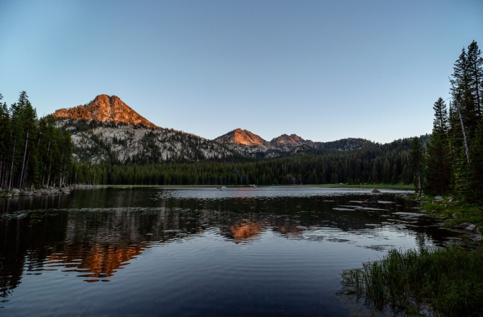
(Gunsight Butte, with its notch characteristic of the Elkhorns, glows in the setting sunlight over Anthony Lake.)
Morris Bishop explains that the notches that are obvious in the bald peaks of the Elkhorn Mountains, most noticeably in the predominate Gunsight Mountain, are characteristic of granitic batholiths, which are full of cracks (known as joints) both large and small. Perhaps these notches reminded someone of the points on an elk’s antlers and led to the Elkhorns’ name.
I recommend pitching a tent at Anthony Lake and doing a loop hike to Hoffer Lakes and back on your first day there. On a following day, more ambitious hikers can follow Sullivan’s directions to Lost Lake or Summit Lake along the Elkhorn Crest Trail, or go all the way to Marble Canyon (or Pass) as both he and Morris Bishop direct, to be picked up or to reach a shuttle car that has been arranged.
Either way, ending your journey near the area known as Little Alps is a great way to say goodbye to the Alps of Oregon and its distinctly American natural and human history — diverse parts jumbled together and torn apart by movement and change, but bonded together as one by time.
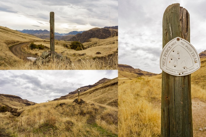
*When planning hikes, make sure to check driving and hiking times and sundown time. [See the Google map I created for this trip: one-way standard drive times are noted in the directions on the sidebar. Click on the hiking icons to see estimated hiking times (not including breaks).] Always bring water, food, first aid supplies and a trail map, and prepare for weather conditions when hiking.
[1]“Status Of Oregon Rocky Mountain Goats”, Victor L. Coggins and Patrick E. Matthews, Oregon Department of Fish and Wildlife
[2] “In the Footsteps of Chinese Miners,” by Lisa Britton of the Baker City Herald, July 13, 2005